Google Earth’s AI deepfake tool only lasted one day

What happened
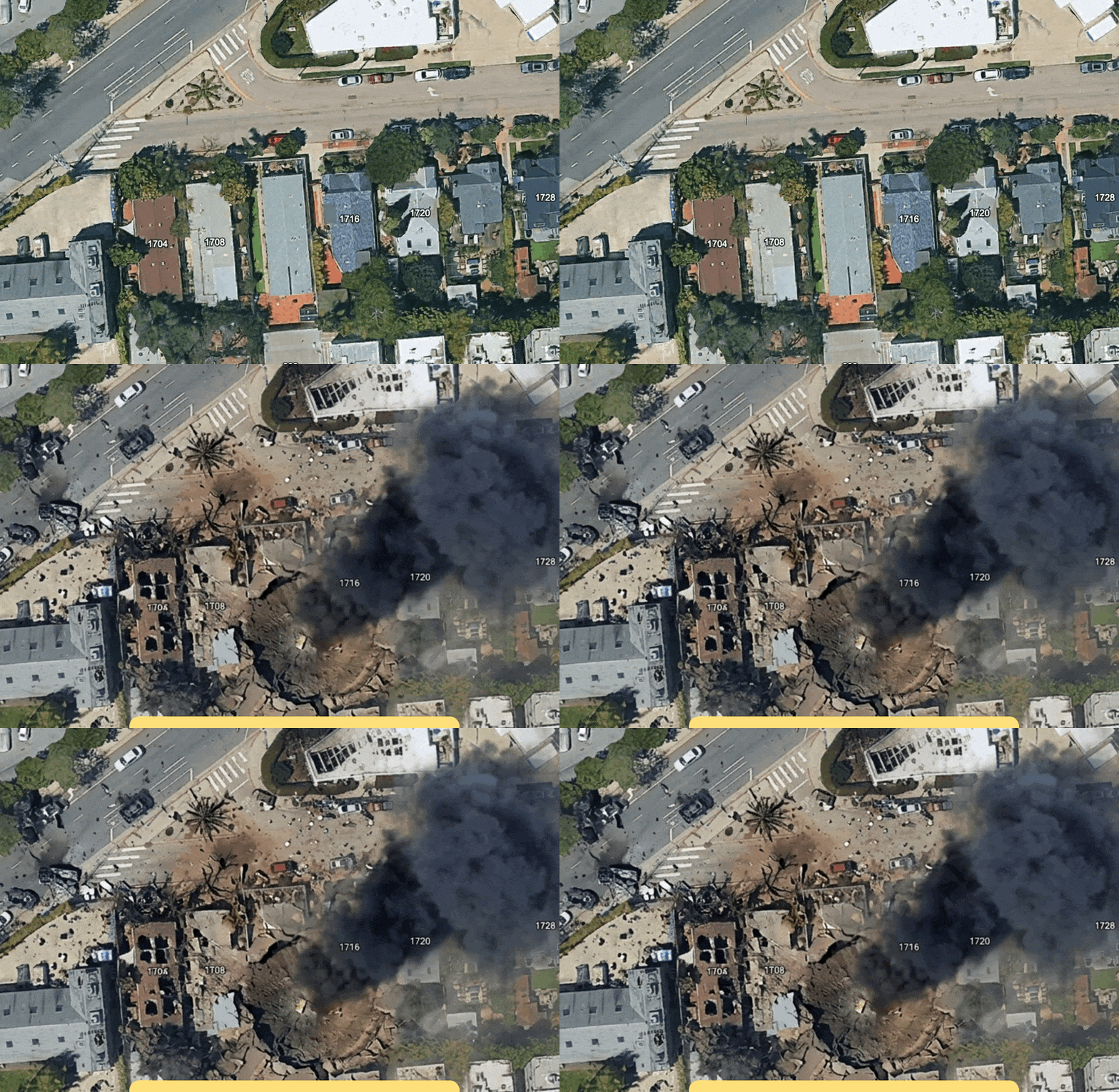
Google launched a feature in Google Earth that let users alter satellite images using AI-generated edits based on text prompts. The tool could insert or change objects in real-world satellite views, creating deepfake versions of familiar locations. Users quickly exploited this, generating misleading images like adding refugees near borders or bomb damage on hospitals. Within a day, Google took the feature offline.
Why it matters
Allowing public AI edits on satellite imagery exposes how easy it is to create manipulated representations of the real world. This raises trust and misinformation risks for anyone relying on satellite data for news, research, or decision-making. The quick shutdown signals that monitoring misuse and controlling AI-generated falsifications in geographic data is urgent. For businesses and regulators, it shows current AI tools can destabilize verified data sources rapidly.
What to watch next
Expect Google and other mapping services to tighten controls around AI image generation with real-world data. Features that allow user-generated edits will need stricter review and safety checks to avoid deepfakes that could influence public opinion or policy. Operators using satellite data should brace for increased complexity in distinguishing authentic from manipulated imagery. Investors and builders should watch how AI image moderation evolves as the intersection of geospatial data and generative AI grows.
AI Quick Briefs Editorial Desk